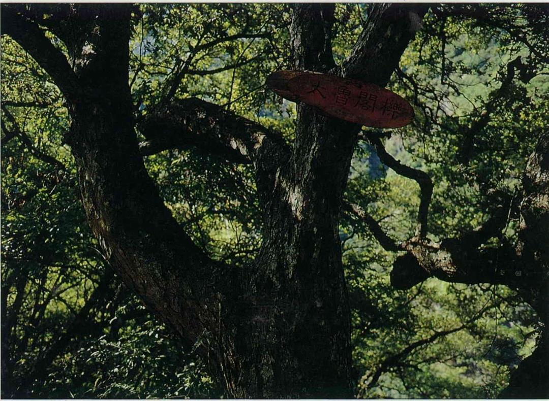
The name Taroko evokes in most people's minds images of the lovely scenery of the Liwu River or the prodigious workmanship of the Central Cross Island Highway. Yet few people realize that, just like the United States' Grand Canyon National Park, these natural splendors were nearly inundated forever under water.
When the Grand Canyon was first discovered, certain parties intended to construct a reservoir in order to irrigate the surrounding areas. Likewise, interested individuals planned to dam the Liwu river to generate electricity. In fact, the Taiwan Power Company embarked upon a number of construction projects.
Fortunately, both projects underwent additional evaluations and were abandoned, the former because water was insufficient, the latter because electricity was insufficient. If those plans had been carried out, today these two world-class national parks would not even exist.
Both Taroko Gorge and the Grand Canyon are superb examples of canyon vistas. The former, though, is narrow and sheer, the latter very vast. Each has its own special quality. The preferred method of traveling in each of these is different, as well. The principal modes of transport in the Grand Canyon are cars, helicopters and horses. Formerly, travelers along Taroko Gorge rode buses, disembarking at scenic spots to snap photos. Now there is an extra option: walking the Old Path or the foot trails.
Some people ask, "What is the fun in walking the old paths?" Who knows if for "busy, bewildered and blind" modern folks, walking slowly through the deep forest and along mountain streams is outright extravagant. And walking in the steps of those who first blazed through these woods, we can experience the same spirit of travel. To meditate or think deeply or intuit the mystique of nature while walking a stretch of the these old trails is like being mysteriously annointed.
Passing under the ceremonial arch at the eastern extreme of the Cross Island Highway in Taroko, one enters the bounds of the national park. The expanse of the river on the right-hand side is wide, its flow leisurely, its surface speckled with the gleam of small stones. More than a few people drive their cars down the gravel road in front of the ticket booth to splash in the water.
In fact, wading across the river at the shallow point to the opposite side where the Liwu and the Shakatang Rivers converge, one reaches the entrance point of one of the seven foot trails specially designated by the Taroko Gorge National Park Administration--the Mysterious Valley Trail. Of the many paths in the park, it is the one closest to the water.
The path was built along the playful, light current of the crisp, green Shakatang River. The little trail runs not far above the river bed. After catching sight of such an unpolluted river, who can resist the temptation to leap into the bubbling waters and swim?
Besides the pure, azure waters of the stream, the boulders and cliffs along the way are even more colorful. Twisted into bizarre shapes, the marble stones reveal white and gray stripes within their creases, one stratum piling on top of another, like a beautiful and tasty multilayered pie.
The entire trail is 4.4 kilometers in length. The route is roughly divided into three sections, with three different landmarks along the way: a police check point, a check dam and a group of cabins called Sanchienwu at the trail's end. Beyond the police check point, one must have a mountain travel permit to continue further, so most people only walk as far as the deep pool in front of the check point and turn back. A leisurely stroll with some stops to have fun along the way will take about an hour; to hike the entire trail takes about two and a half hours.
Besides communing with water and stone along the Mysterious Valley trail, there are six other designated trails within the national park: TaliTatung, Lushui-Holiu, Baiyang, Huoran Pavilion, Lotus Lake, and the Plum Garden and Bamboo Village trails.
The Tali-Tatung trail, the longest route requiring two days with an overnight rest, is adjacent to Mysterious Valley. The two share a common path, and you can enjoy them both at the same time. But this path requires a type A mountain travel permit, and the journey is particularly difficult; most visitors do not elect to hike it.
Some of these well-planned and magnificent hiking trails follow the Old Path and others are constructed along the roads that the Taiwan Power Company had used in the past. Generally, their ranges are clustered along the first section near the entrance to Taroko, the middle and the rear sections around Tienhsiang, but none of them are in the gorge area.
The famous Taroko Gorge area is located along the section of road running from the Swallow Grotto, past the Chinheng Bridge, Liufang Bridge, Chulu Tunnel and the Tunnel of Nine Turns to the Tzumu Bridge. Stretching for more than ten kilometers, cliffs thrust upward into the heavens on both sides, leaving only a thin strip of sky. The highway winds along a ledge of the cliff, returning the same way, affording a tremendous view.
The topography of Taiwan is still rising. Whenever a terrain increases in elevation, inevitably it produces the phenomenon of rivers carving paths downward. Taroko Gorge is no exception. Because this area's layer of marble is extremely thick and hard, the Liwu River continues to slice downward, and both sides of the river's flow tend to resist crumbling or collapse. The more the river cuts, the deeper its bed is carved. The effect is sheer cliffs which form the scenic wonder that is today's gorge.
This trail was built up from the original Hohuan Cross-Mountain Path. It is the smallest trail and also the first self-guided path (requiring no tour guide). The entire route is two kilometers long and takes about 45 minutes to traverse. It is suitable for the Here the road is incredibly narrow, squeezing in places to a single lane. In addition, the marble stone is very solid, and it is not very easy to chisel out a trail. There are only a few small sections where foot paths have been constructed along the outside of the vehicle lane. Visitors must park their cars along wide spots and step out to enjoy the beautiful vistas.
Many visitors riding tour buses disembark at a certain point along the gorge and walk along the edge viewing the scenery. They get back on the bus further on, thus saving the trouble of walking back to where they started.
Once out of the gorge, one arrives at the Lushui-Holiu trail, three kilometers distant from Tienhsiang.
This trail was built up from the original Hohuan Cross-Mountain Path. It is the smallest trail and also the first self-guided path(requiring no tour guide). The entire route is two kilometers long and takes about 45 minutes to traverse. It is suitable for the whole family, young and old, to enjoy together.
Lushui has an exhibition hall introducing the ecological resources and geographical scenery within the park. The entrance is next to the National Park Police Headquarters Building.
This path is perfectly flat, and walking along it makes no great demands on one's energy, but it does include some breathtakingly dangerous parts. For instance, one stretch of road runs along the narrow point of a precipice. Although the outer ledge is protected by railing, one feels a sense of complete exhilaration. This is also the location along the trail with the finest vantage point. One can view from after the river bluffs of Lushui and look straight down upon the torrential Liwu River dropping down, the Central Cross Island Highway at its foot.
The path also enters a mountain cave for a stretch. Although the distance is not great, for a moment after leaving the bright outdoors and entering the darkness, one must manage step by step.
You may consider acquiring the travel manual for this route before you set out. Pictures inform you of various fruit trees, such as peach, plum, prune and cherry. Nearby you can catch sight of a camphor forest. There are 20 self-guiding sign posts over the entire trail, including descriptive anecdotes of the waterways, rocks and several plants.
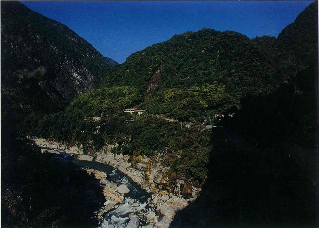
After Lushui, the Liwu river bed becomes wider, and suddenly at Tienhsiang the terrain becomes broad and open. This is the most important locale in the national park.
Tienhsiang is located at the convergence of Tashah River and Liwu River. Because the geological structure is relatively soft, the lateral erosion force of the rivers is powerful and the range of disintegration is expansive, so that river bluffs of greater magnitude have developed here. There are four levels of river bluffs, on which have been constructed a plum garden, parking facilities, a bus station and a hotel district.
In the mountain valleys, flat areas are relatively few. The river bluffs are the only source of land that can be used. In times past, the Atayal people and even earlier prehistoric people carried out their lives on the river bluffs. Later on, some of the workers who helped to construct the Central Cross Island Highway settled down in this area and cultivated fruit trees along the river bluffs. Even today many of the national park's recreational facilities are completed upon the bluffs. It is evident that from ancient times until the present day, the places people choose for habitation, agriculture and hunting have been very similar.
Originally the Atayal people lived above the Chuoshui River on the west slope of the Central Mountain Range, in the area of present day Mt. Lu in Nantou County. Their population increased, the soil became impoverished and the fields were no longer sufficient. So between 250 and 300 years ago, they traveled over mountains and valleys to settle down along the river bluffs of the Liwu River. Later as the population proliferated, they branched off and left for different destinations, creating many small settlements.
Between every river bluff settlement they made a common path going back and forth. Today, of the four trails planned by the national park in the vicinity of Tienhsiang, the Lotus Lake Trail and the Plum Garden and Bamboo Village Trail are both built upon the meeting trails of the Atayal along the Taosai River. The Baiyang Trail uses a Taiwan Power Company construction path, and the Huoran Pavilion Trail connects two points along the Central Cross Island Highway.
These four trails vary in length, and their level of difficulty is different as well. But Baiyang Trail has the highest number of visitors.
The conditions of this trail are excellent; it is entirely covered in smooth gravel. It is from three to five meters in width. The starting point is about 300 meters from Tienhsiang in the direction of Wenshan. Its entrance is actually a tunnel about 380 meters long, which takes about six minutes to walk through. The foremost feature of this trail is that it passes through many tunnels, 25 throughout the whole route. Visitors had best prepare a flashlight for this excursion.
Its second special feature are water curtains. Forty minutes and about two kilometers into the hike, you can see the Baiyang Waterfall rushing down like a chain of white gold. The stone underneath the waterfall has been eroded to form a pool, crystal clear to the very bottom. Not far from the falls is the first water curtain tunnel, on the outside of which many adventuresome visitors have left behind their raincoats.
After putting on some rain gear and entering the tunnel, one encounters spring water gushing down like a cloud burst from the tunnel's ceiling, the weight of the water pounding against rain gear produces an extremely shocking sound. Visitors should feel prepared to get wet, because no matter how tightly one is insulated, the streams of water will surely find a way to seep through. This is as magical in its own way as riding the boat "Maid of the Mist" under Niagara Falls.
After passing through the water curtain, one can see a water screen on the side of the rock, formed by a mountain spring. Above it is bright jade-green moss. Many visitors turn back at this point, making the return journey in approximately two and a half hours.
Recently, the National Park Administration commissioned a geologist to inspect the water curtain tunnel, and the danger of falling rocks was detected. Unfortunately, the tunnel had to be closed to protect the safety of visitors.
The Chulu Cliff Path and the Liwu River Excavation Path are two tracks within the park that are not planned routes, and their level of difficulty is probably the highest. Yet, if you want to experience the genuine sensation of the Taroko Gorge's splendor, you can attempt to hike the16-kilometer Chulu Cliff Path.
From the #71 tunnel along the Central Cross Island Highway, you can see a bamboo bridge down below, crossing over the Liwu River. This is the current starting point for the Old Chulu Cliff Path. Because of a landslide the original foot trail leading down to the bridge from the highway has been destroyed, hikers must find their own path of descent through the rocky debris.
On the far side of the bamboo bridge is a wide and visible foot path. This path climbs the embankment, and after about an hour it rises to Patakang at a height of 450 meters. Patakang is a river bluff. Standing on its outer edge, one can see the Cross Island Highway around the area of the Swallow Grotto. On the rock can be seen traces of a cableway.
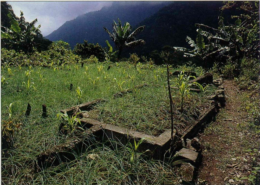
This point was an early Atayal settlement. Of the Japanese era police outpost that was built later, two pillars still remain. And three aboriginal folk--Chuo Wen-ming, his wife and a friend named Kao--still live here, planting corn, bananas, lilies and other crops. Outside their house they grow chrysanthemums, indispensable for decorating aboriginal headwear.
Further on a few minutes walk is the newly built Patakang #2 Bridge. The old suspension bridge had at one time been destroyed, and hikers had to walk three hours to the bottom of the Patakang River and back up the opposite side. On the other side of the bridge, the road climbs an embankment and approximately one hour later enters a tunnel and passes through to the quintessential stretch of road skirting the Chulu Cliffs. At a height of 770 meters above sea level, the view is astonishing and vast; the quality of the road is excellent.
Looking down from the old path on top of the cliff is like staring down at a city from a hundred-storey skyscraper. Those with limited reserves of courage might find themselves trembling at the knees.
Afterwards, the path runs along the ledge of the precipice, becoming tremendously perilous. This is the unique feature of the Old Chulu Cliff Path. Pay attention to the width of your backpack; if it brushes the wall of the cliff, you might be in danger of plunging off the edge.
On the western side of the second tunnel, the path climbs onto a large mesa, the best lookout point in the region. Afterwards, the path gradually descends and soon the road returns to the original location of the police outpost. Going forward, one comes to a memorial marker. Etched on it is "Hualien Harbor Patrol Officer Daigoro," but the origins of this sign are now unknown.
While investigating the Chulu Cliff Path, "old path expert" Yang Nan-chun discovered that before the Japanese reconstructed this road, the path was no wider than 30 or 40 centimeters. At the time, when the aborigines walked the route, "Everyone walked like crabs with their backs to the cliff face; from start to finish, no one dared say a word." Whoever was the least bit careless plunged over the side of the cliff.
Afterwards when the Japanese widened this stretch of road, they also encountered considerable disturbances, because the Japanese construction workers felt the job was too dangerous and one by one sneaked away. So Japanese management resorted to conscripting local Atayal strongmen from neighboring villages. When they worked, they strapped a metal safety belt around their waist, rappelling down from the cliff top. They chiseled holes in which they inserted dynamite, blasting a road that widened at best to about 1.5 meters.
Because marble is very, very hard, blazing a trail here is a particularly arduous task; for this very reason, however, the Chulu path has to this day been maintained in excellent condition. This old path has been designated a historical preservation area.
If any visitor passes in between the Swallow Grotto to the Tzumu Bridge, all they must do is crane their heads upward and gaze at the cliffs to know how difficult it was to carve a road out of this terrain as slick as glass.
These small foot paths and trails have gone from being the indigenous people's "settlement trails" in earliest times, to being "military affairs roads" or "barbarian management roads," to being the "fitness trails," "historical sites" and "scenic routes" of today's national park. Their roles have often changed, but their importance is the same as of old.
If you are accustomed to traditional methods of travel, you might as well come to Taroko National Park and, depending on your own physical ability, available time and accommodations, discover the romance of the trail. Along the way you may also gain a sense of the price paid in passion by those who walked this way before you.
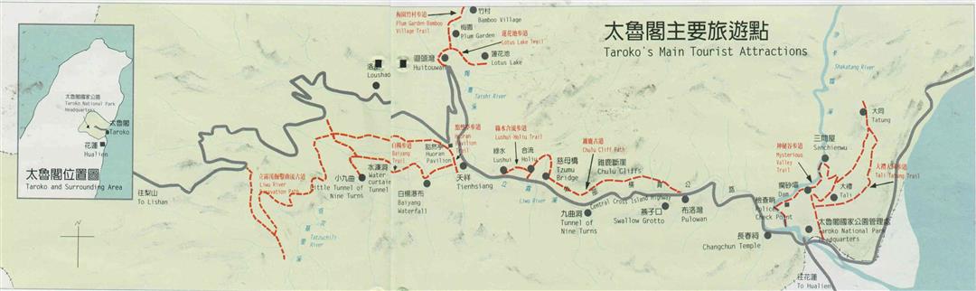
Taroko's Main Tourist Attractions
(Map drawn by Lee Su-ling)
Changchun Shrine:
At this point the Liwu River makes a bend. Steps are built along the mountain face, leading up to the Chankuang temple.
Pulouwan:
Here there are upper and lower river bluffs. Upon the upper river bluff are built 12 grass houses which can be used as accommodations. The lower river bluff has a circular theater grounds, offering a multi-media presentation.
Swallow Grotto:
Inside the Tunnel of Nine Turns is the choicest section of road in the gorge, but due to the narrow squeeze, traffic jams are common.
Tzumu Bridge:
At this scenic rest stop, one can admire the precipitous plunge of the Chulu Cliffs.
Tienhsiang:
With hotels, a bus station and parking facilities, Tienhsiang serves most visitors as a base point for further exploration along the foot trails. It is also the starting point for the Huoran Pavilion Trail.
Lotus Lake:
The national park's only high mountain lake. Workers constructing the Cross Island Highway cultivated the orchard here. The mountain village offers over-night accommodations.
Travel Information
Routes:
Because there are only limited hotel and dining accommodations, most tourists stop and turn around at Tienhsiang. There are many different hiking routes of varying degrees of difficulty on which you can spend anything from a few hours to a week.
Information:
The number of the Taroko Gorge National Park Headquarters is (038) 621-100.
Food:
There are only places to eat around the bus station in Tienhsiang; you can only get instant noodles at the Taroko Gorge headquarters building.
Hotels:
These are concentrated around Tienhsiang, and include the China Youth Corps Activities Center, the Catholic Hostel, the Christian Hostel, and the Wenshan Hotel. The China Travel Service Hostel is closed for renovation. Of the various trails, only Lotus Lake has cabins to stay in.
Getting Around:
Only one major road runs through the Taroko National Park. Because it is a narrow mountain road, there are many places where only one vehicle can pass at a time, and traffic jams can occur if drivers are not generous and patient.
There are many tunnels of one-way stretches on this road, but because of the beauty of the scenery, many travelers thoughtlessly stop on the road to take photographs, creating traffic jams.
There is little public transport. Only the Taiwan Bus Company and the Hualien Bus Company run there, with only 10 busses per day going from Hualien to Tienhsiang, Lishan, and Taichung. Of these, eight set off before noon, so you have to be careful.
[Picture Caption]
p.90
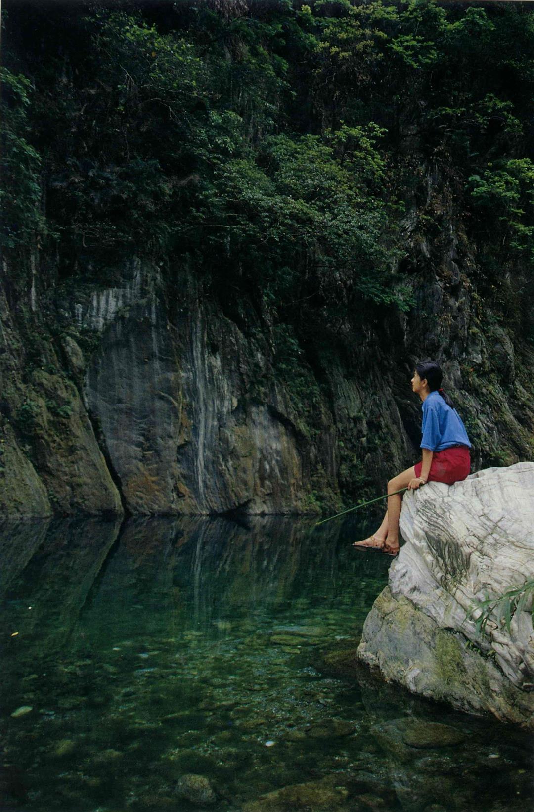
The Mysterious Valley is a constant dialogue between visitors and the lovely wonders of water and stone. (photo by Diago Chiu)
p.92
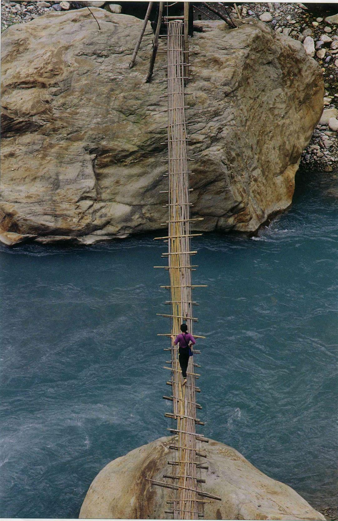
Roll up your trouser legs and wade across the river. Bid farewell to the mundane world and be a joyous traveler of mountain streams. (photo by Diago Chiu)
p.93
The Chulu Trail is full of breathtaking danger. Following the cliff's edge, one should carry along an extra degree of courage. (photo courtesy of Taroko National Park Headquarters, photo by Chang Chensan)
p.94
When walking the Lushui-Holiu trail which was built from the old path, although the trail is short, one can gain an impression of the hardships of those who built it. (photo by Diago Chiu)
p.95
The cliff section of the Lushui-Holiu Trail is the place with the most stunning wilderness view; Liwu River and the bluffs of Lushui swallow up one's vision.
p.95
Using sign posts and a travel manual to replace a tour guide is the special feature of the Lushui-Holiu self-guiding foot trail. (photo by Diago Chiu)
p.96
Tunnels are one of the special attractions of the Baiyang Trail. There are 25 along the route, and hikers had best prepare lighting equipment.
p.97
The color and texture of marble is uniformly celestial.
P97
The rain gear piled up outside the water curtain tunnel is a remarkable sight in and of itself. But due to the danger of falling rocks, the tunnel has been temporarily closed.
p.98
Currently the starting point for the Chulu Cliff Foot Trail is this bamboo suspension bridge stretched across the Liwu River bed.
p.99
This kind of Japanese era outpost building has vanished in a puff ot smoke, save for these foundations in Patakang.
P.99
Mr. and Mrs. Chuo Wen-chun are members of the Taroko tribe. They still live on Patakang, carrying out the old-style agricultural ways. Every so often they must descend the mountain to buy small goods.
p.100
From "settlement trails" to "barbarian management roads" to "scenic routes," their roles have changed, but their importance is the same as of old.
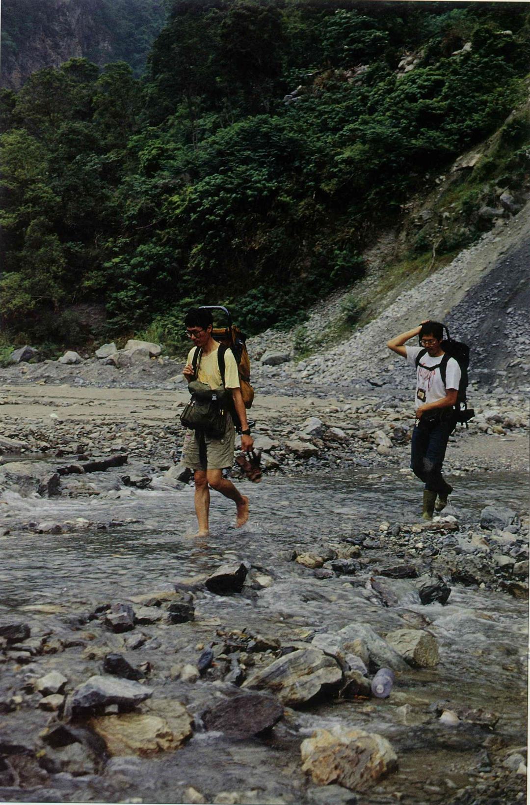
Roll up your trouser legs and wade across the river. Bid farewell to the mundane world and be a joyous traveler of mountain streams. (photo by Diago Chiu)
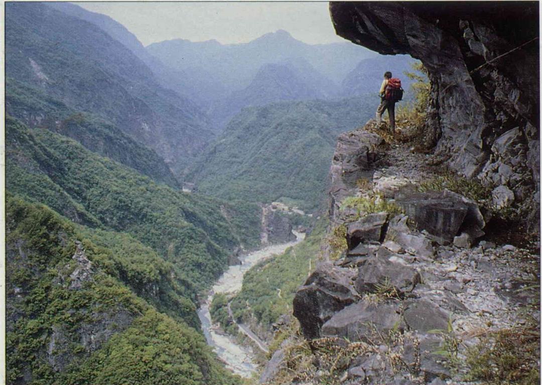
The Chulu Trail is full of breathtaking danger. Following the cliff's edge, one should carry along an extra degree of courage. (photo courtesy of Taroko National Park Headquarters, photo by Chang Chensan)
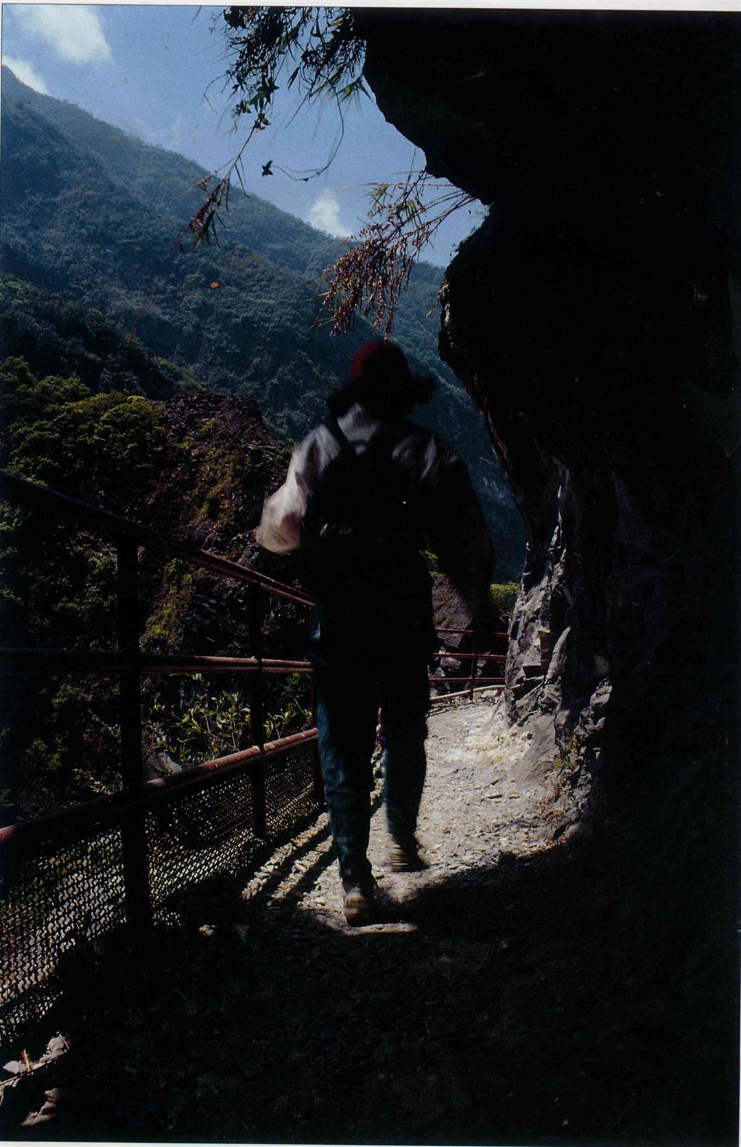
When walking the Lushui-Holiu trail which was built from the old path, although the trail is short, one can gain an impression of the hardships of those who built it. (photo by Diago Chiu)
The cliff section of the Lushui-Holiu Trail is the place with the most stunning wilderness view; Liwu River and the bluffs of Lushui swallow up one'sision.
Using sign posts and a travel manual to replace a tour guide is the special feature of the Lushui-Holiu self-guiding foot trail. (photo by Diago Chiu)
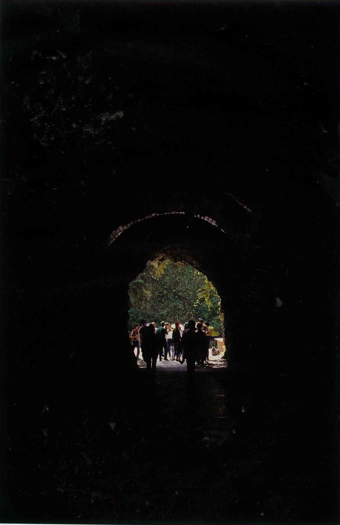
Tunnels are one of the special attractions of the Baiyang Trail. There are 25 along the route, and hikers had best prepare lighting equipment.
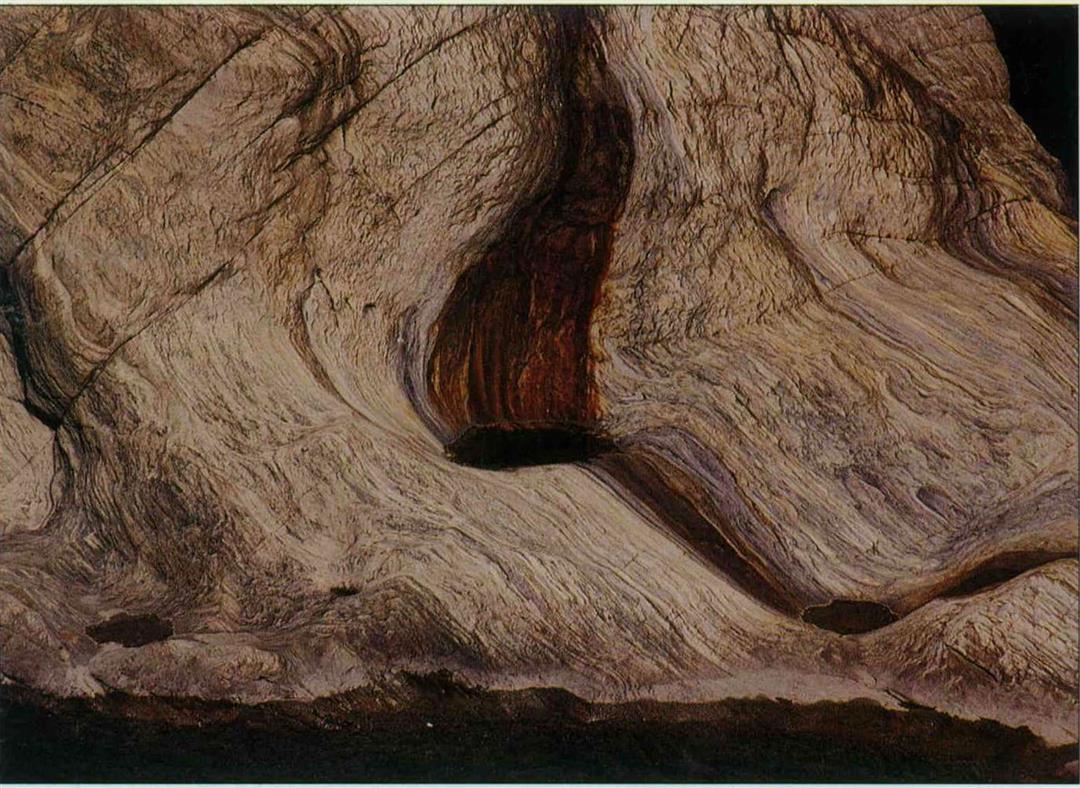
The color and texture of marble is uniformly celestial.
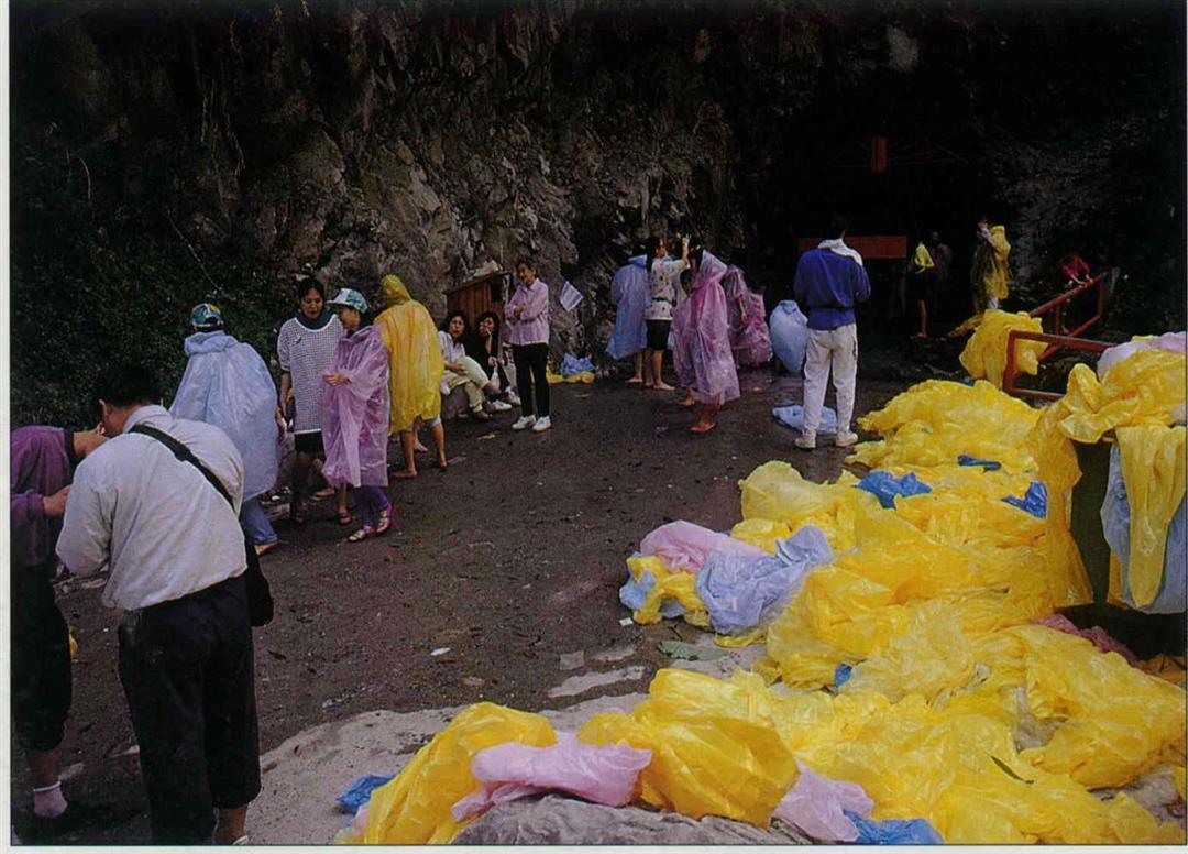
The rain gear piled up outside the water curtain tunnel is a remarkable sight in and of itself. But due to the danger of falling rocks, the tunnel has been temporarily closed.
Currently the starting point for the Chulu Cliff Foot Trail is this bamboo suspension bridge stretched across the Liwu River bed.
This kind of Japanese era outpost building has vanished in a puff ot smoke, save for these foundations in Patakang.
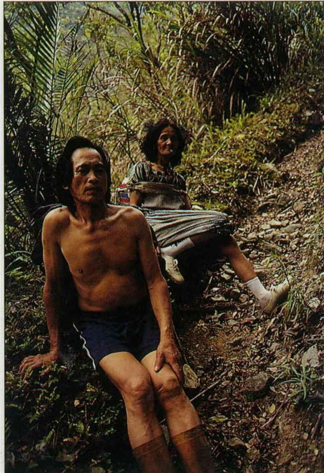
Mr. and Mrs. Chuo Wen-chun are members of the Taroko tribe. They still live on Patakang, carrying out the old-style agricultural ways. Every so often they must descend the mountain to buy small goods.
From "settlement trails" to "barbarian management roads" to "scenic routes," their roles have changed, but their importance is the same as of old.
@List.jpg?w=522&h=410&mode=crop&format=webp&quality=80)

@List.jpg?w=522&h=410&mode=crop&format=webp&quality=80)
@List.jpg?w=522&h=410&mode=crop&format=webp&quality=80)